 |
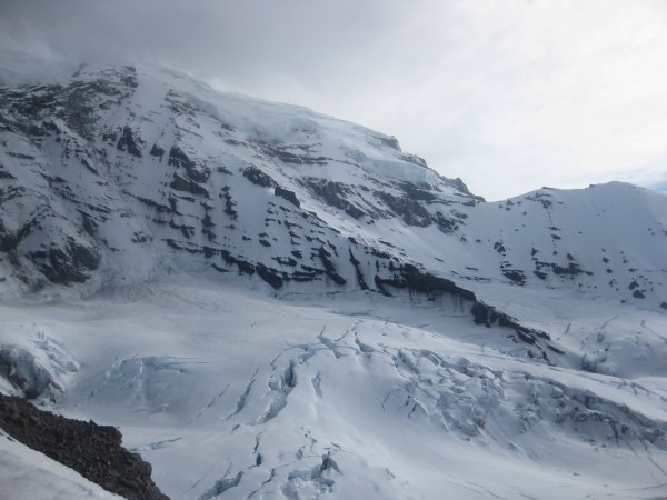
| Liberty Ridge on Mt. Rainier (as seen from Curtis Ridge) |
After getting off Denali in under two weeks my partner and I realized we have another week of vacation left. We can either get back to work earlier and start making money, or quickly find another climb. Since on Denali we did not feel challenged by the minimal amount of actual climbing and had no solitude, we picked Liberty Ridge - a route featured in "Fifty Classic Climbs of North America" by Steve Roper and Allen Steck. This 5,000ft ridge divides the stunning North Face of Mt. Rainier and features an approach through the Carbon Glacier. Checking the Mt. Rainier conditions web site left us with no other concerns, the route is 'in.'
<iframe width="420" height="315" src="http://www.youtube.com/embed/3mJsszyw1BY" frameborder="0" allowfullscreen></iframe>
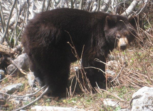
The drive to the White River campground was exciting. Views of the mountain were supplemented with elk and bear sightings. Fear of running out of gas on the way back was overshadowed with excitement about the coming climb, and worry about the weather that was predicted to be a coin-flip between precipitation and sunny days - welcome to the PNW. When Shane and I obtained our permit, we received sad news- "There is a rescue currently on Liberty Ridge. Actually not a rescue, it is a body recovery." The ridge claimed another life a day before we started our approach. During the actual approach we had the courtesy of watching Chinook and other helicopters buzzing over the North side of the mountain.
The approach is actually very pleasant and scenic. A mile or so in we saw a bear consuming some grass off the trail. The river flowing along the trail allows one to have access to water for most of the way up to Elmo Pass. This trail is taken by hikers, backpackers, and climbers. Approach through White River campground is taken mostly by climbers going up Emmons Glacier (probably the easiest/safest route up Mt. Rainier with a bit more elevation gain than standard Camp Muir (DC) option. But one could also approach Curtis Ridge, Liberty Ridge, Ptarmigan ridge, and routes on Willis and Liberty wall from White River as well.
After we got over Elmo Pass the weather started to deteriorate. By the time we reached Winthrop Glacier we were in a full whiteout. Being a stubborn bunch we continued on and ended up camping around 8,700ft on Curtis ridge. I scrambled up to the top of Curtis ridge during a clear window and discovered us way above the supposed campground (by about 1,500ft or so). At least the views of Liberty Ridge were beautiful, and the pictures turned out nice! We are young, making days harder than they should be is a good idea! The night ended up being a bit windy and cloudy, but the morning was beautiful. We were above the clouds and made our way down the Curtis ridge, towards Carbon glacier.
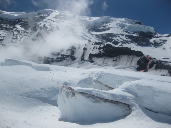
Reaching the glacier ended up being straight forward and as we traversed bellow overhanging wall of Curtis ridge... BAMMM!!!!!!WTFF!!!! A soccer sized chunk of volcanic rock fell between Shane and I, breaking into several pieces, producing an exploding sound, and dusting the air around us. Without saying a word we moved quick through the scree and towards the entrance on to the glacier. The rock came within two meters or so from taking one of us out. Helmet would not do a damn thing to prevent a lethal injury from a rock like that. Not wearing a helmet on this route is NOT an option.
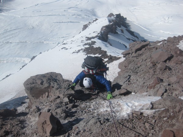
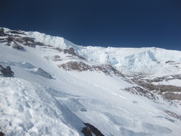
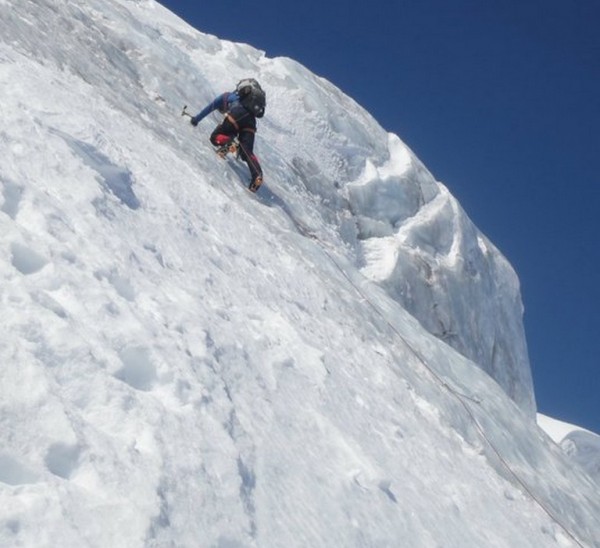
As we worked our way up the glacier the sun began to heat things up. Part ways up we were getting fried, and our energy was drained by the heat. It is always a better idea to travel on the glacier in the early hours of the day for stronger snow bridges, and less heat. As we got to the ridge we decided to skip the traverse to the gentler slopes on the other side, and climbed a direct couloir that put us on the crest within minutes. We crossed a bergshrund and climbed a steep snow/ice/dirt mix to the crest of the ridge. After topping out we saw a set of foot marks- 'Yay! We didn't cliff out!' After that we climbed close to the crest of the ridge for the remainder of our way up to Thumb Rock camp. On the way we encountered some steeper sections and 3/4th or so class steps to get over, but they were very short. If one wants, all the scrambling can be bypassed by gentler slopes on the right side. The weather was a mix of wind and intermittent cloudiness by now. We saw a few slides on Liberty Wall, but nothing impressive, YET.
We worked our way up and crossed to the other side of the ridge a couple of times, than we finally made it to camp. To our surprise there was a 6 person guided group up there. After two days of being mostly alone we didn't mind to see another group. It was reassuring hearing that they camped for an extra day up there because supposedly the next day will be nice for summiting, with gentler winds on top. After building walls for our Firstlight we made food, boiled water, and went to sleep.
In the morning on the 16th of June we were almost ready to head up. Guided group left about 3 hours earlier than us, and was almost out of view higher on the ridge. I heard a noise, turned around and saw a massive ice avalanche running down the Willis Wall. I have seen avalanches before, but not quite like this one. Couple of times it launched through mid air and reached the bottom of this 5,000ft face in about 30 seconds. Lucky enough I was able to tape the whole thing. The day was only beginning, but we had seen fireworks!
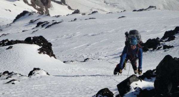
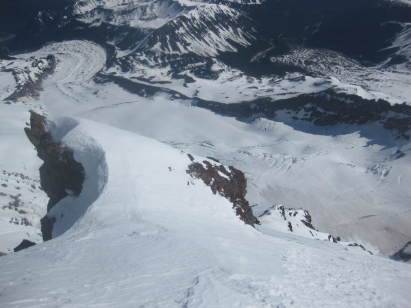
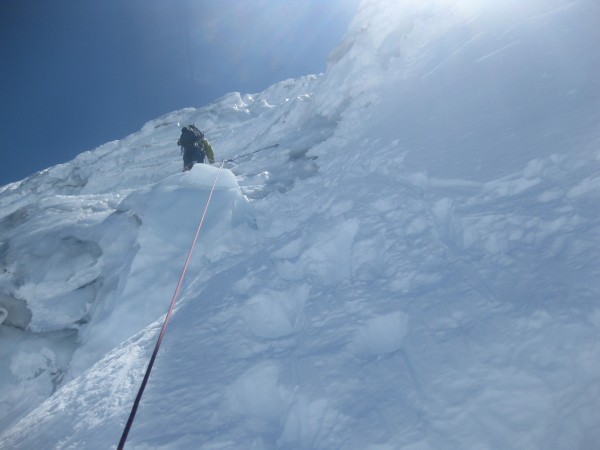
Finally we got ready and got on our way up the ridge. Most of the slopes were about 45 degrees or so covered in nice hard snow. All the slopes include a drop off to the glacier, so falling would not be a good idea. We didn't plan to die here so we didn't fall.
Climbing towards Black Pyramid we enjoyed the views. The weather was beautiful- we were above the clouds and wind was mostly bellow 20 mph, even during gusts. Than we reached the section of steeper climbing up to 55 degrees or so which was right before the Black Pyramid.
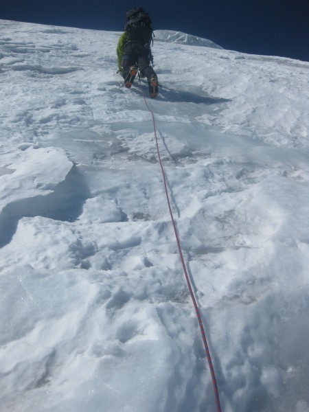
Again it was a snow/neve slope with amazing exposure. After reaching the Pyramid we finally got on some alpine ice. Shane took the first pitch he found and we simul soloed through it. I saw another solid blue pitch off to the side and went for it. We were almost caught up to the guided group by that point so wasting time on more fun climbing was not a problem. We simul climbed through this section and made our way up to the bergshrund.
Although our acclimation from Denali and overall physical fitness paid off, by this point high altitude slowed us down a bit and we didn't move as fast as we did through lower section of the ridge. Waiting for the guided group to negotiate the shrund gave us a bit of needed rest. Shane got over the shrund and than I set off to catch up to the guided group.
On the ice/rime pitch above the snow slope I went around them. This was fun because the sticks were mostly secure and angle very moderate. I sprinted the pitch without placing any screws and got some rest while waiting for my partner. From there it is mostly a hike up to the Liberty Cap (14,112 ft)-which is qualified as a separate peak due to it's 492 ft of prominence. At this point the wind picked up and we continued our hike towards the true summit of Mt. Rainier. I heard a lot of people fall into crevasses on the hike from Liberty Cap and true summit- I didn't plan to fall in one on this trip so we did a good job navigating this section without any incident.
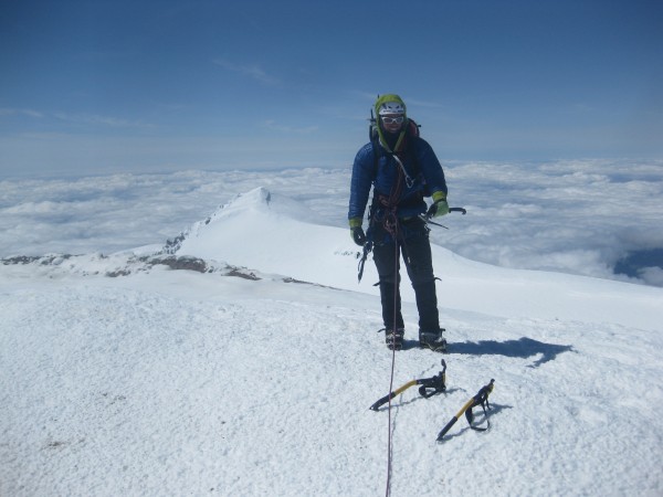
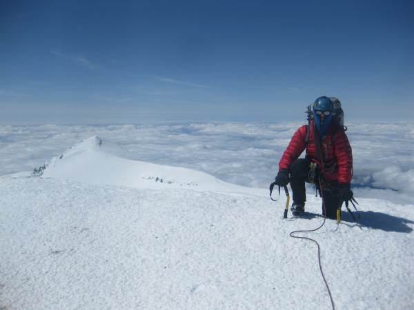
Close to the true summit the winds were booming at constant 45mph or so. We took a few summit shots, but didn't stay out for too long. From here we saw that the guided group was resting just bellow Liberty Cap. Waving the summit good bye, we made our way down the Emmons Glacier, and to Camp Schurman. The hike out was a bit long, but our bitterness was sweetened with over a thousand feet of awesome glissading.
Although I didn't meet Ed Viestrus or take Melissa Arnot on a date, the amount of fun I had on this trip was overwhelming. At times you do not have to travel as far as you think to have a great time!

No comments:
Post a Comment